
Order Total (1 Item Items):
Shipping Destination:

9780008387990 - London A-z Street Atlas by Geographers? A-z Map Co Ltd (30 results)
Skip to main search results
Product Type
- All Product Types
- Books (30)
- Magazines & Periodicals
- Comics
- Sheet Music
- Art, Prints & Posters
- Photographs
- Maps
- Manuscripts & Paper Collectibles
Condition
Binding
- All Bindings
- Hardcover
- Softcover (30)
Collectible Attributes
- First Edition
- Signed
- Dust Jacket
- Seller-Supplied Images (7)
- Not Print on Demand (30)
Free Shipping
Seller Location
Seller Rating
-
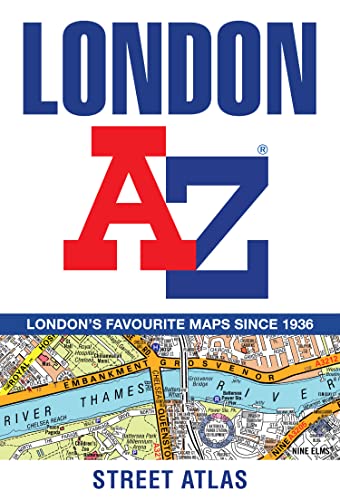
London A-Z Street Atlas
Published by Geographers' A-Z Map Co Ltd, 2020
ISBN 10: 0008387990ISBN 13: 9780008387990
Book
Paperback. Condition: Good. The book has been read but remains in clean condition. All pages are intact and the cover is intact. Some minor wear to the spine.
-
London A-Z Street Atlas
Published by HarperCollins Publishers, United Kingdom, London, 2020
ISBN 10: 0008387990ISBN 13: 9780008387990
Book
Paperback. Condition: Very Good. Navigate your way around London with this detailed, easy-to-use and up-to-date A-Z Street Atlas. First published in 1936, this iconic atlas is a trusted means of finding your way around the capital city. The main mapping extends beyond Central London from Heathrow Airport to Chingford at a scale of 2.88 inches to 1 mile, featuring postcode districts, one-way streets, the Congestion Charging Zone and Low Emission Zone. The large-scale street map of Central London at a scale of 5.75 inches to 1 mile cover Regents Park and Shoreditch, Chelsea and Vauxhall, Hyde Park and Bermondsey. A comprehensive index lists streets, selected flats, walkways and places of interest, place, area and junction names. Additional healthcare (hospitals, walk-in centres and hospices) and transport connections (National Rail, London Tramlink, Docklands Light Railway, London Underground and Overground stations, and River Bus pier) are indexed as well. Also included are: Overview map of the Congestion Charging Zone West End Theatre map London Connections rail services map London Underground map. The book has been read, but is in excellent condition. Pages are intact and not marred by notes or highlighting. The spine remains undamaged.
-

London A-Z Street Atlas
Published by Geographers� A-Z Map Co Ltd, 2020
ISBN 10: 0008387990ISBN 13: 9780008387990
Book
Condition: VeryGood. Most items will be dispatched the same or the next working day.
-
London A-Z Street Atlas (Paperback)
Published by HarperCollins Publishers, London, 2020
ISBN 10: 0008387990ISBN 13: 9780008387990
Book
Paperback. Condition: new. Paperback. Navigate your way around London with this detailed, easy-to-use and up-to-date A-Z Street Atlas. First published in 1936, this iconic atlas is a trusted means of finding your way around the capital city. The main mapping extends beyond Central London from Heathrow Airport to Chingford at a scale of 2.88 inches to 1 mile, featuring postcode districts, one-way streets, the Congestion Charging Zone and Low Emission Zone.The large-scale street map of Central London at a scale of 5.75 inches to 1 mile cover Regents Park and Shoreditch, Chelsea and Vauxhall, Hyde Park and Bermondsey.A comprehensive index lists streets, selected flats, walkways and places of interest, place, area and junction names. Additional healthcare (hospitals, walk-in centres and hospices) and transport connections (National Rail, London Tramlink, Docklands Light Railway, London Underground and Overground stations, and River Bus pier) are indexed as well.Also included are: Overview map of the Congestion Charging Zone West End Theatre map London Connections rail services map London Underground map Navigate your way around London with this detailed, easy-to-use and up-to-date A-Z Street Atlas. First published in 1936, this iconic atlas is a trusted means of finding your way around the capital city. Shipping may be from multiple locations in the US or from the UK, depending on stock availability.
-
![Seller image for London A-Z Street Atlas [Soft Cover ] for sale by booksXpress](https://pictures.abebooks.com/inventory/md/md31165801930.jpg)
London A-Z Street Atlas [Soft Cover ]
Published by Geographers� A-Z Map Co Ltd, 2020
ISBN 10: 0008387990ISBN 13: 9780008387990
Book
Soft Cover. Condition: new.
-
London A-Z Street Atlas
Published by HarperCollins Publishers, 2020
ISBN 10: 0008387990ISBN 13: 9780008387990
Book
PAP. Condition: New. New Book. Shipped from UK. Established seller since 2000.
-
London A-Z Street Atlas
Published by Geographers� A-Z Map Co Ltd, 2020
ISBN 10: 0008387990ISBN 13: 9780008387990
Book
Condition: Good. Most items will be dispatched the same or the next working day.
-
London A-Z Street Atlas
Published by HarperCollins Publishers 2020-03-05, London, 2020
ISBN 10: 0008387990ISBN 13: 9780008387990
Book
paperback. Condition: New. Language: ENG.
-
London A-Z Street Atlas
Published by Geographers� A-Z Map Co Ltd, 2020
ISBN 10: 0008387990ISBN 13: 9780008387990
Book
Paperback. Condition: New. BRAND NEW ** SUPER FAST SHIPPING FROM UK WAREHOUSE ** 30 DAY MONEY BACK GUARANTEE.
-
London A-Z Street Atlas
Published by Harpercollins Publishers, 2020
ISBN 10: 0008387990ISBN 13: 9780008387990
Book
Paperback / Softback. Condition: Brand New. 464 pages. 7.56x5.12x0.87 inches. In Stock.
-
London A-Z Street Atlas
Published by HarperCollins Publishers, 2020
ISBN 10: 0008387990ISBN 13: 9780008387990
Book
Paperback / softback. Condition: New. New copy - Usually dispatched within 4 working days.
-
London A-Z Street Atlas
Published by Geographers' A-Z Map Co Ltd, 2020
ISBN 10: 0008387990ISBN 13: 9780008387990
Book
Condition: New. Buy with confidence! Book is in new, never-used condition 1.15.
-
London A-Z Street Atlas
Published by Geographers' A-Z Map Co Ltd, 2020
ISBN 10: 0008387990ISBN 13: 9780008387990
Book
Condition: New. In.
-
London A-Z Street Atlas
Published by HarperCollins Publishers, 2020
ISBN 10: 0008387990ISBN 13: 9780008387990
Book
Condition: New. 2020. Paperback. . . . . .
-
London A-Z Street Atlas
Published by HarperCollins Publishers, 2020
ISBN 10: 0008387990ISBN 13: 9780008387990
Book
Condition: New. 2020. Paperback. . . . . . Books ship from the US and Ireland.
-
London A-Z Street Atlas
Published by Geographers' A-Z Map Co Ltd, 2020
ISBN 10: 0008387990ISBN 13: 9780008387990
Book
Condition: new.
-
London A-Z Street Atlas
Published by Geographers' A-Z Map Co Ltd, 2020
ISBN 10: 0008387990ISBN 13: 9780008387990
Book
Paperback. Condition: very good. Very Good Copy. Customer Service Guaranteed.
-
London A-Z Street Atlas
Published by Geographers? A-Z Map Co Ltd, 2020
ISBN 10: 0008387990ISBN 13: 9780008387990
Book
Condition: new.
-
London A-Z Street Atlas
Published by Geographers' A-Z Map Co Ltd, 2020
ISBN 10: 0008387990ISBN 13: 9780008387990
Book
Paperback. Condition: new. Brand New Copy.
-
London A-Z Street Atlas
Published by Geographers' A-Z Map Co Ltd, 2020
ISBN 10: 0008387990ISBN 13: 9780008387990
Book
Paperback. Condition: new. New.
-
London A-Z Street Atlas
Published by Geographers' A-Z Map Co Ltd, 2020
ISBN 10: 0008387990ISBN 13: 9780008387990
Book
Paperback. Condition: new. Buy for Great customer experience.
-
London A-Z Street Atlas
Published by HarperCollins Publishers, 2020
ISBN 10: 0008387990ISBN 13: 9780008387990
Book
PAP. Condition: New. New Book. Shipped from UK. Established seller since 2000.
-

London A-Z Street Atlas
Published by Harpercollins Publishers M�r 2020, 2020
ISBN 10: 0008387990ISBN 13: 9780008387990
Book
Taschenbuch. Condition: Neu. Neuware - Navigate your way around London with this detailed, easy-to-use and up-to-date A-Z Street Atlas. First published in 1936, this iconic atlas is a trusted means of finding your way around the capital city. The main mapping extends beyond Central London from Heathrow Airport to Chingford at a scale of 2.88 inches to 1 mile, featuring postcode districts, one-way streets, the Congestion Charging Zone and Low Emission Zone. The large-scale street map of Central London - at a scale of 5.75 inches to 1 mile - cover Regent's Park and Shoreditch, Chelsea and Vauxhall, Hyde Park and Bermondsey. A comprehensive index lists streets, selected flats, walkways and places of interest, place, area and junction names. Additional healthcare (hospitals, walk-in centres and hospices) and transport connections (National Rail, London Tramlink, Docklands Light Railway, London Underground and Overground stations, and River Bus pier) are indexed as well. Also included are:- Overview map of the Congestion Charging Zone- West End Theatre map- London Connections rail services map- London Underground map 464 pp. Deutsch.
-
London A-Z Street Atlas
Published by Geographers' A-Z Map Co Ltd, 2020
ISBN 10: 0008387990ISBN 13: 9780008387990
Book
Paperback. Condition: very good. In Used Condition.
-
London A-Z Street Atlas
Published by Geographers' A-Z Map Co Ltd, 2020
ISBN 10: 0008387990ISBN 13: 9780008387990
Book
Paperback. Condition: very good. Purchase pre-owned books for prompt service and customer satisfaction.
-
London A-Z Street Atlas
Published by Geographers' A-Z Map Co Ltd, 2020
ISBN 10: 0008387990ISBN 13: 9780008387990
Book
Paperback. Condition: new. New Copy. Customer Service Guaranteed.
-
London A-Z Street Atlas
Published by Geographers' A-Z Map Co Ltd, 2020
ISBN 10: 0008387990ISBN 13: 9780008387990
Book
Paperback. Condition: new. New. Fast Shipping and good customer service.
-

London A-Z Street Atlas (Paperback)
Published by HarperCollins Publishers, London, 2020
ISBN 10: 0008387990ISBN 13: 9780008387990
Book
Paperback. Condition: new. Paperback. Navigate your way around London with this detailed, easy-to-use and up-to-date A-Z Street Atlas. First published in 1936, this iconic atlas is a trusted means of finding your way around the capital city. The main mapping extends beyond Central London from Heathrow Airport to Chingford at a scale of 2.88 inches to 1 mile, featuring postcode districts, one-way streets, the Congestion Charging Zone and Low Emission Zone.The large-scale street map of Central London at a scale of 5.75 inches to 1 mile cover Regents Park and Shoreditch, Chelsea and Vauxhall, Hyde Park and Bermondsey.A comprehensive index lists streets, selected flats, walkways and places of interest, place, area and junction names. Additional healthcare (hospitals, walk-in centres and hospices) and transport connections (National Rail, London Tramlink, Docklands Light Railway, London Underground and Overground stations, and River Bus pier) are indexed as well.Also included are: Overview map of the Congestion Charging Zone West End Theatre map London Connections rail services map London Underground map Navigate your way around London with this detailed, easy-to-use and up-to-date A-Z Street Atlas. First published in 1936, this iconic atlas is a trusted means of finding your way around the capital city. Shipping may be from our UK warehouse or from our Australian or US warehouses, depending on stock availability.
-

London A-Z Street Atlas (Paperback)
Published by HarperCollins Publishers, London, 2020
ISBN 10: 0008387990ISBN 13: 9780008387990
Book
Paperback. Condition: new. Paperback. Navigate your way around London with this detailed, easy-to-use and up-to-date A-Z Street Atlas. First published in 1936, this iconic atlas is a trusted means of finding your way around the capital city. The main mapping extends beyond Central London from Heathrow Airport to Chingford at a scale of 2.88 inches to 1 mile, featuring postcode districts, one-way streets, the Congestion Charging Zone and Low Emission Zone.The large-scale street map of Central London at a scale of 5.75 inches to 1 mile cover Regents Park and Shoreditch, Chelsea and Vauxhall, Hyde Park and Bermondsey.A comprehensive index lists streets, selected flats, walkways and places of interest, place, area and junction names. Additional healthcare (hospitals, walk-in centres and hospices) and transport connections (National Rail, London Tramlink, Docklands Light Railway, London Underground and Overground stations, and River Bus pier) are indexed as well.Also included are: Overview map of the Congestion Charging Zone West End Theatre map London Connections rail services map London Underground map Navigate your way around London with this detailed, easy-to-use and up-to-date A-Z Street Atlas. First published in 1936, this iconic atlas is a trusted means of finding your way around the capital city. Shipping may be from our Sydney, NSW warehouse or from our UK or US warehouse, depending on stock availability.
-
A-Z LONDON STREET ATLAS
Published by Geographers' A-Z Map Co Ltd, 2020
ISBN 10: 0008387990ISBN 13: 9780008387990
Book
Condition: NEW.